Artificial islands: Pantai Maju dan Pantai Kita
Artificial islands: Pantai Maju dan Pantai Kita
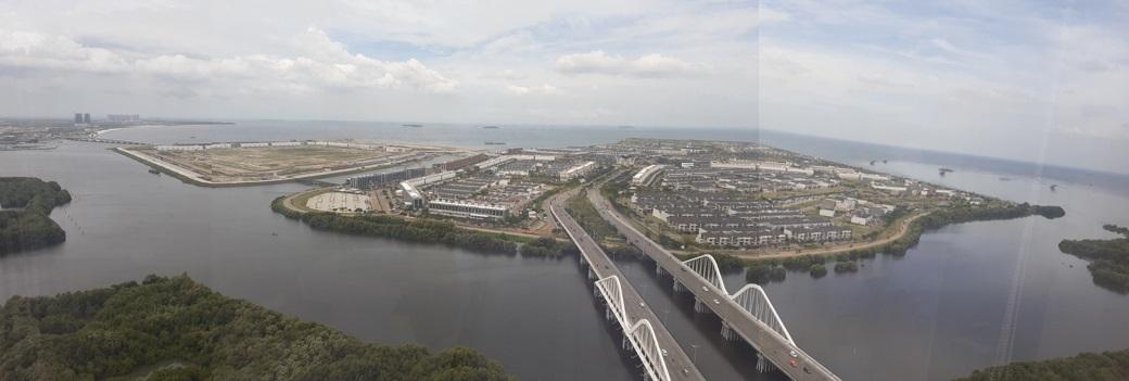
Creating land from water: something the Dutch have a long and successful history of doing. Since 1987 Witteveen+Bos has been involved in land reclamation for Pantai Indah Kapuk, Kapuk Naga Indah and Tangerang International City. As part of these developments, a series of ten artificial islands have been planned for just off the coast of Jakarta. The city has grown beyond the capacity of its current boundaries and is looking to expand northward into the Sea of Java.
The islands ‘Pantai Maju dan Pantai Kita’ – roughly translated: ‘Golf Island and River Walk Island’ – are two of the planned developments. These islands formed a challenging project as the offshore polders comprising them were reclaimed on extremely soft soil approximately ten metres deep. The stability calculations that formed part of both the design and construction phases needed to adequately take these circumstances into account. Construction methods had to be attuned to this and verifying actual site conditions was essential.
85,000 people on extremely soft soil
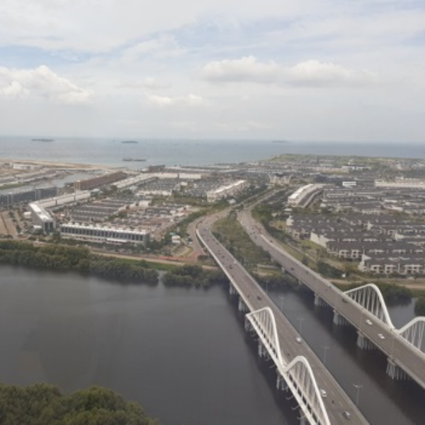
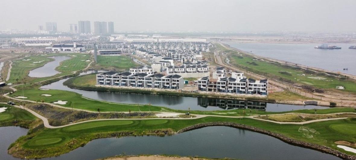
Reclamation works for Pantai Maju (‘Golf Island’) started in 2012 as part of the Kapuk Naga Indah land development project. Our experts prepared both the conceptual and detailed design for the island, the southern part of which is intended to be a residential area. The reclaimed area’s water management system was designed in close coordination with our water management, geotechnical and coastal experts. We prepared a detailed engineering design for the drainage systems, which included the construction of pumping stations (civil works, mechanical, electrical and automation). Following the erection of sea defences and pumping stations, a polder system located below sea level was created to house over 85,000 people. This unique polder system will keep residents safe despite the extremely soft soil, the anticipated effects of climate change, and issues resulting from land subsidence.
After completion of the island’s southern part, development of the northern part (which includes a golf course) began. The design for the water management system needed to be validated against the existing total system design so that a cohesive polder system could be realised. Our experts also supported the client in interpreting the results of long-term measurements conducted on the island to monitor changes in surface level.
Reclamation works for the second island, ‘River Walk Island’, began in 2014. We prepared the conceptual and detailed design and were involved in providing technical support right up to completion of the works in 2018. Development of the water management system and infrastructure for the reclamation area started in 2020, for which we prepared a detailed engineering design for the drainage systems, which included the construction of pumping stations (civil works, mechanical, electrical and automation). Currently, the island’s development is at the halfway stage.
More information?
We happily answer all questions. Please contact us via the form.


