Hydrodynamics and morphology
Expertise with growing added value

Hydrodynamics and morphology
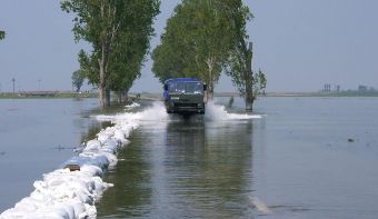
Most of the world’s population lives near rivers or coasts. Climate change, sustainable development goals and changing needs of people lead to projects in which expertise of water movement and sediment transport is essential. Witteveen+Bos’ experts in hydrodynamics and morphology are engaged by clients worldwide in projects related to energy transition, climate change adaptation, management of vital infrastructure, improvement of natural areas and design and assessment of structures for flood protection, ports, river management and river interventions, among others.
Applications
Typical applications for hydrodynamics and morphology include performing systems analyses to understand water movement (water levels, wave climate, currents) and soil changes (sediment transport, erosion and sedimentation) within a project area, preparing design conditions for hydraulic engineering structures, analysing the operational availability of harbours, and determining the consequences of project implementation, such as for the purpose of licensing.
For offshore cables and pipelines, we are involved in both the design (such as route tracing, burial depth, environmental impact) and asset management (such as analysis of exposure washout due to seabed changes, hydrodynamic loading).
Tools
For our studies, our experts use physics-based complex numerical models such as XBeach, Delft3D, SWAN, SWASH, DELWAQ and COMSOL. The scales at which these models are applied range from parts of structures (waterways in locks and pumping stations) to parts of oceans and coastal areas covering an area of hundreds of square kilometres and covering much of what lies in between (such as ports, river sections).
This video shows an example of a modelling exercise (SWAN). It shows a wave model of the Red Sea set up, calibrated and validated by us.
Development of in-house models
Witteveen+Bos also develops in-house models and tools to analyse specific hydrodynamic and morphological effects. For instance, we developed a model to calculate wave impact on harbours (WIHA model) and collaborated on the development of a tool to determine sedimentation in navigation channels and ports (CoDeS). We use these tools to make quick and accurate assessments that are very valuable in studying alternatives or in preparatory phases of design projects.
Interaction between hydraulics and structures
In projects, our experts assess whether hydraulic designs meet all requirements and thus contribute to optimising these designs. Depending on the type of structure, the methodology is determined. This ranges from empirical equations to complex numerical software.
One of our specialisations is the application of Computational Fluid Dynamics (CFD). CFD provides insight into detailed flow fields around objects, enables the possibility to study design alternatives and facilitates the collection of data at desired locations without the need for expensive measurement campaigns. We have applied CFD in the design of locks, lock gates, ports, fish passages, tidal turbines and sewage systems, among others.
Metocean
Metocean studies are essential when designing both offshore and near-shore structures. Witteveen+Bos collects global data on wind, waves and tidal currents from field observations, satellite data and numerical models. Based on statistical analyses, we derive wind and offshore wave climates.
We use numerical models such as SWAN (spectral wave analysis), WIHA (mild-slope models), Delft3D and SWASH (hydrodynamic models) to calculate onshore, detailed wave climates and flow patterns.
Morphology
Both riverbeds and seabeds can be morphologically dynamic. In projects we determine their expected morphological developments. For example, to determine the maintenance dredging volumes of navigation channels, to determine the required burial depth of cables and pipes or as part of the integrity management of existing assets. For morphological studies, we use our in-house developed toolboxes to perform data analyses and deploy numerical sediment-transport models to understand natural sediment transports in the project area.


More information?
