Pedestrian-inclusive design for Rotterdam South
Building walkable, liveable and connected southern neighbourhoods
Pedestrian-inclusive design for Rotterdam South
Over the past year, the Municipality of Rotterdam and Witteveen+Bos have been exploring at how the living environment for pedestrians can be improved in the Afrikaanderwijk, Tarwebuurt and Bloemhof neighbourhoods. The central question was: ‘How can you break through the isolation of the neighbourhood and connect it to the city axis, thereby increasing the mobility of residents and allowing them to benefit from the new green developments?’
Rotterdam South is undergoing large-scale spatial developments, such as the Nelson Mandela Park, the area development in the Rijnhaven and the city axis in the south. Our assignment is to look at how the three neighbourhoods can connect to these current projects. It is co-financed by the Creative Industries Fund NL, within the open call Roads to Well-being.
In this project, we explicitly focus on the neighbourhoods in Zuid and their residents. There are two reasons for the research: the relatively modest focus on pedestrians in design and policy, and identifying and realising concrete improvements through pedestrian-inclusive design.
Data-driven analysis
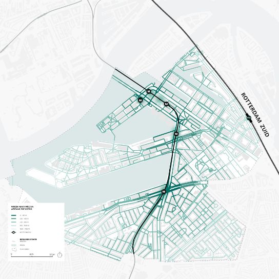
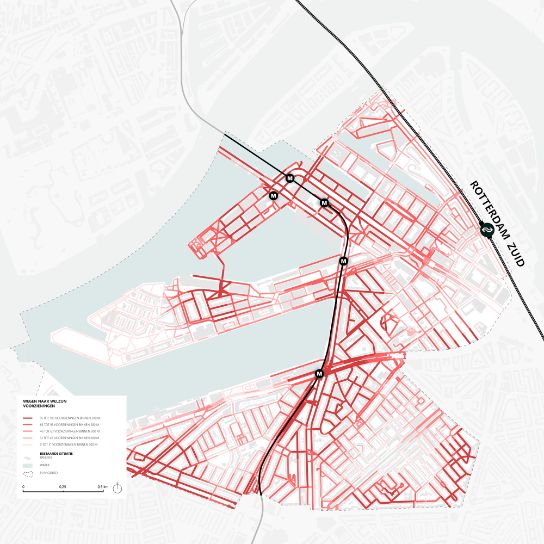
The Pedestrian Traffic Monitor was used to map the pedestrian network in the neighbourhoods and analyse the various walking indicators. The Pedestrian Traffic Monitor is a data-driven analysis platform developed by Witteveen+Bos in collaboration with the municipality of Rotterdam. The Pedestrian Traffic Monitor provides information at neighbourhood or city level about pedestrians and the pedestrian network and shows the intensity, capacity and quality for pedestrians at street level.
In addition to this data-driven analysis, quantitative analyses, interviews with local experts, walking discussions and breakfast sessions with residents were used to gather ideas for safer, greener and better-connected walking routes.
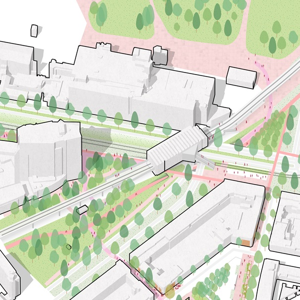
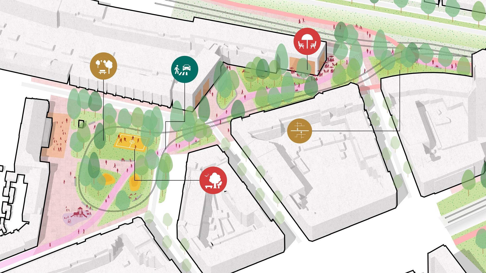
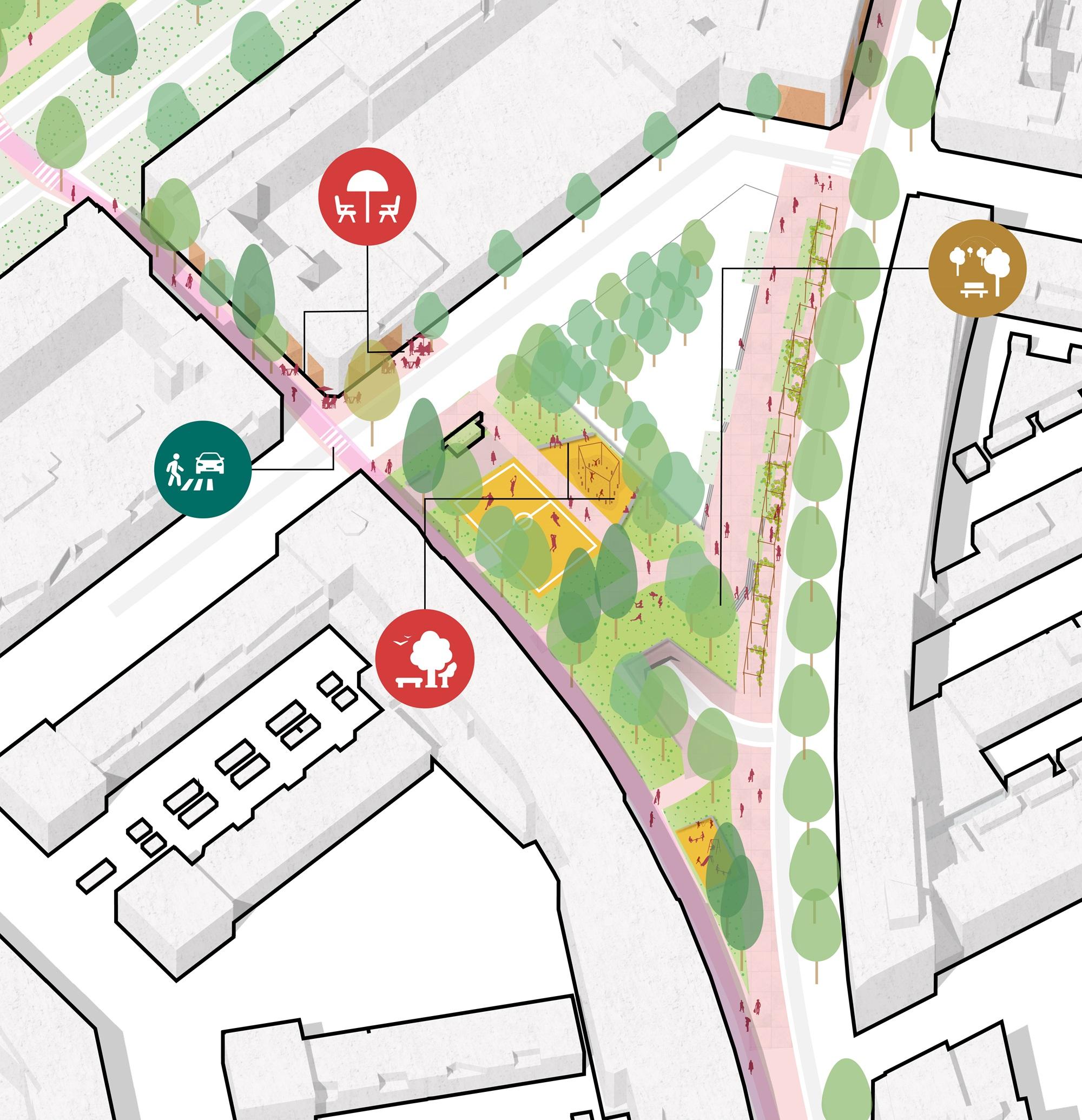
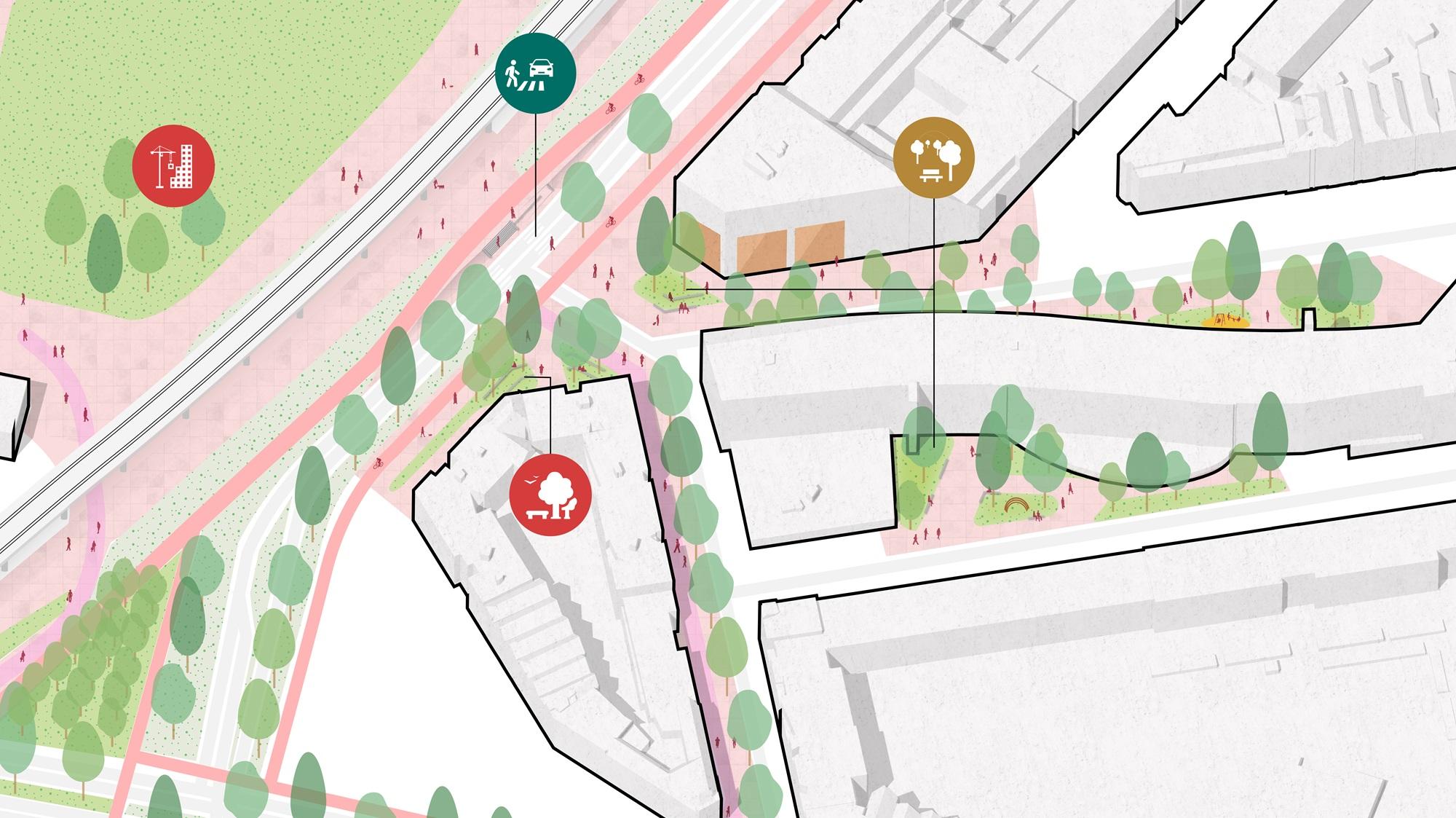
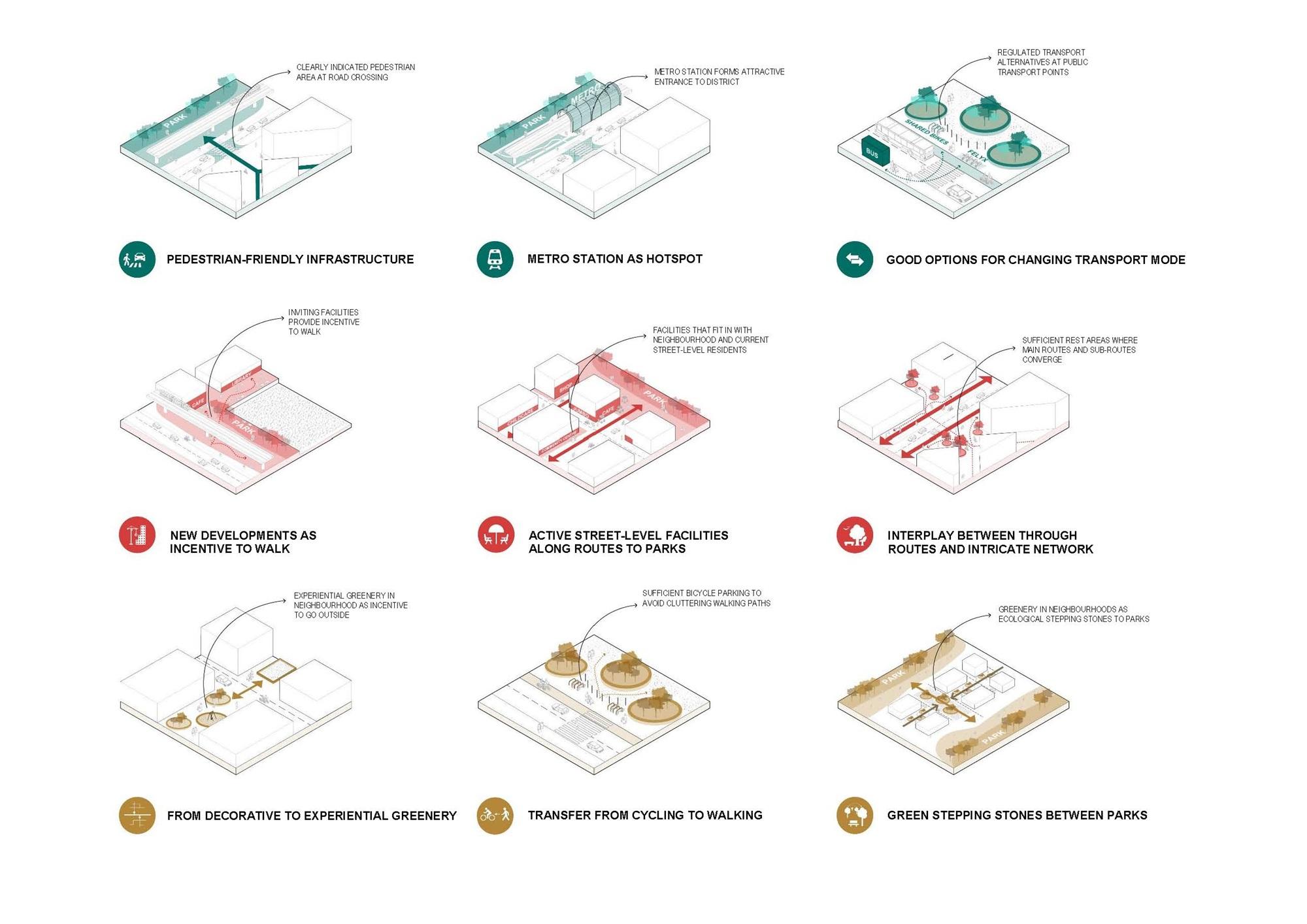
Locations with potential
The first phase of the project looked at how residents could benefit from the development of the new Rijnhaven and Maashaven parks. In the second phase, three locations were identified based on the conclusions from the initial analysis. These are locations that currently score poorly in terms of pedestrian-friendliness but also have a lot of potential.
Design proposals have been made for these locations to connect the public space to the parks. The emphasis is on the pedestrian network, combating transport poverty, increasing the accessibility of the parks and improving access to public transport for everyone.
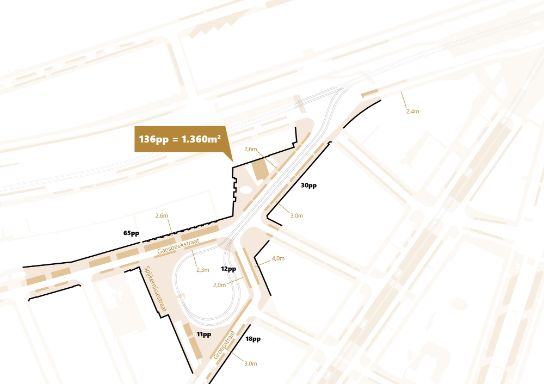
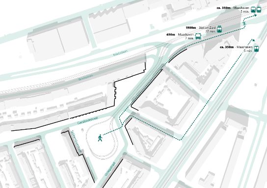
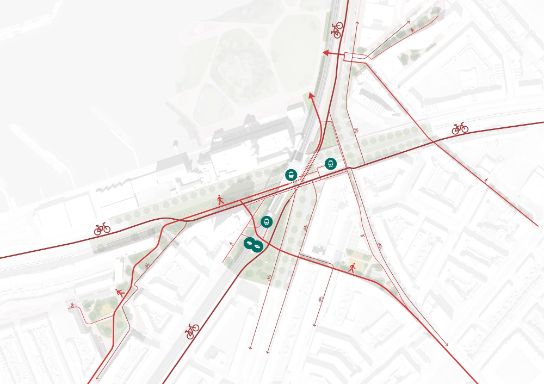
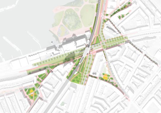
Maashaven in 2040
The design proposals are specific to the area around the Maashaven traffic circle. They form the basis for a vision for Maashaven in 2040, including a renovated metro station and an optimal connection to Nelson Mandela Park.
Bringing expertise together
For this project, Witteveen+Bos has opted for an integrated approach, in which urban planners, mobility experts, data scientists and policymakers pool their knowledge and experience. This accelerates and deepens the identification of opportunities for pedestrian-inclusive design and leads to high-quality and creative designs.
More information

