‘Bodemlabels’ help guide water and soil management
‘Bodemlabels’ help guide water and soil management
The ‘Bodemlabels’ method (soil labels) provides insight into how area development projects relate to the natural soil and water system and soil quality. The method is intended for local authorities, water boards and provincial authorities, as well as professionals in the spatial domain such as designers, (area) developers, planners and soil professionals. Witteveen+Bos is one of the initiators*.
Importance of the soil
The soil plays a crucial role in our ecosystems and life on earth. At the same time, the soil is also crucial in major spatial challenges such as urbanisation, agricultural transition, biodiversity, infrastructure and mobility, energy transition and water challenges.
These spatial challenges facing the Netherlands now and in the coming decades must all find a place in this scarce space. Space that is under pressure not only above ground but also below ground.
Basis of our existence
For a long time (and still too often), we humans have manipulated the soil and water systems to suit our needs. We thought that all land use was malleable, but we now know better. It is time that we no longer take the soil for granted, but give it the attention it deserves for a sustainable future.
‘Bodemlabels’ web tool and serious game ‘Bodemlabels’
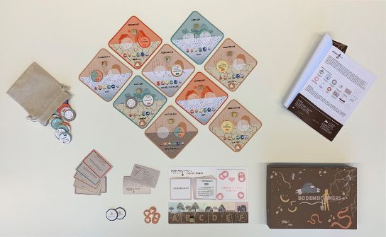
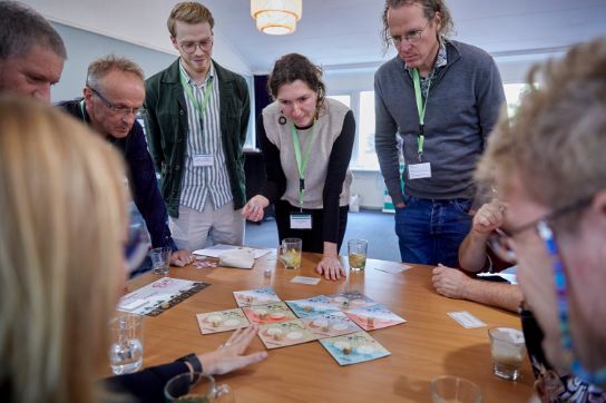
‘Bodemlabels’ consists of two parts: the physical game ‘Bodemlabels’ and the online web tool ‘Bodemlabels’. Both encourage a rethink and a look at “where” and “how” developments can take place. This encourages designers and policymakers to use expert knowledge to gain new insights and create an integrated living environment. In short, a call for design power!
What is ‘Bodemlabels’?
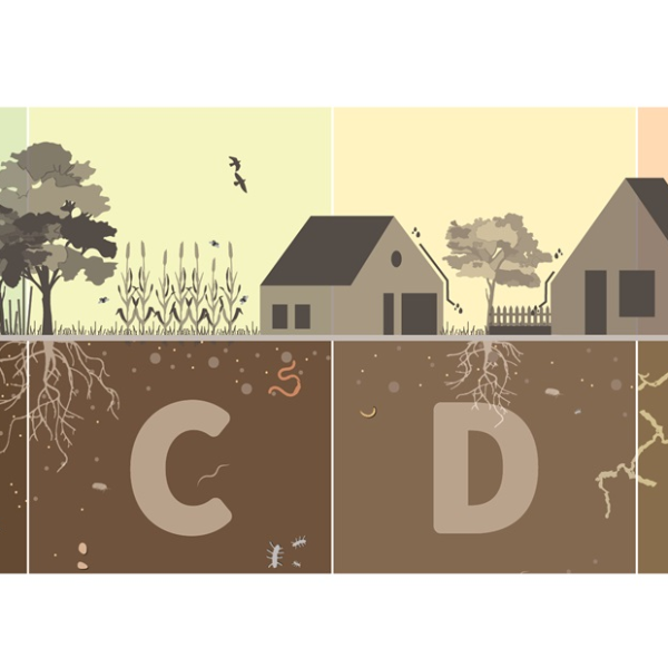
‘Bodemlabels’ is a method, including a web tool, that provides insight and concrete tools for water and soil-driven spatial development, creating vital soils at the development site.
The ‘Bodemlabels’ website and tool provide insight into the relationship between land use and the water and soil system of an area. The method encourages discussion about spatial planning in the Netherlands and contributes to making smart choices for land use, design and management that are appropriate to the conditions of the landscape and improve water and soil quality. ‘Bodemlabels’ is in line with the policy of authorities, such as water boards, provinces and municipalities, to implement “water and soil-driven” actions.
When to use ‘Bodemlabels’?
- If you want to set an ambition prior to a project.
- If you are looking for a suitable location for development when you are in the planning/design phase.
- If you want to improve the soil quality of an existing/selected location.
What is the ‘Bodemlabels’ serious game?
This serious game allows players to discover how the principle of “water and soil-driven” influences spatial planning. It brings together current spatial challenges such as agricultural transition, mobility, water, nature, energy transition and urbanisation, with one goal: winning together and achieving vital soil!
*The underlying knowledge for ‘Bodemlabels’ was gathered during two years of design research by the consortium of the Spatial Traineeship Central Netherlands, consisting of H+N+S, WING, Witteveen+Bos and Waterschap Vallei en Veluwe. This project was made possible in part by the open call “building from the soil” from the Creative Industries Fund.
More information?

